|
We are continuing to add to our product line of CDXStreamer browser-based tools. A new application for Geographic Access Analysis has just been released.
Geographic Access
Analysis (also known as closest store analysis) is a method used to
assess the proximity of various resources, services, or facilities in
relation to specific geographic locations. It is an essential report
needed by business, the medical industry, government, and other fields.
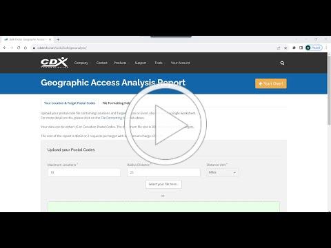
This tool allows
you to upload a set of location postal codes along with a list of target
postal codes in a spreadsheet in an excel or .csv file. The user
can set a radius distance along with the maximum number of targets to be
returned before starting. A report will then be produced which
orders the locations by distance in ascending order for each
target. Only targets within the radius specified up to the maximum
number will be shown. Both US Zip Codes and Canadian Postal Codes
are supported.
For a tutorial on using the new app please see the following video.
|