Welcome to the free Zip Code Distance application from CDX Technologies. This tool now supports both US zip codes and Canadian postal codes! A quick tutorial on how to use this tool is covered in this youtube video.
This software tool will allow you to calculate straight line (as the crow flies) or driving distance for any pair of US or Canada zip/postal codes. Just enter your two zip codes in the boxes above and press the "Generate" Report button. The distance can be optionally specified in miles, kilometers or nautical miles. The HERE API is used for the driving distance calculation and displayed map for the fastest route. CDXGeodata is used for the straight line distance calculation
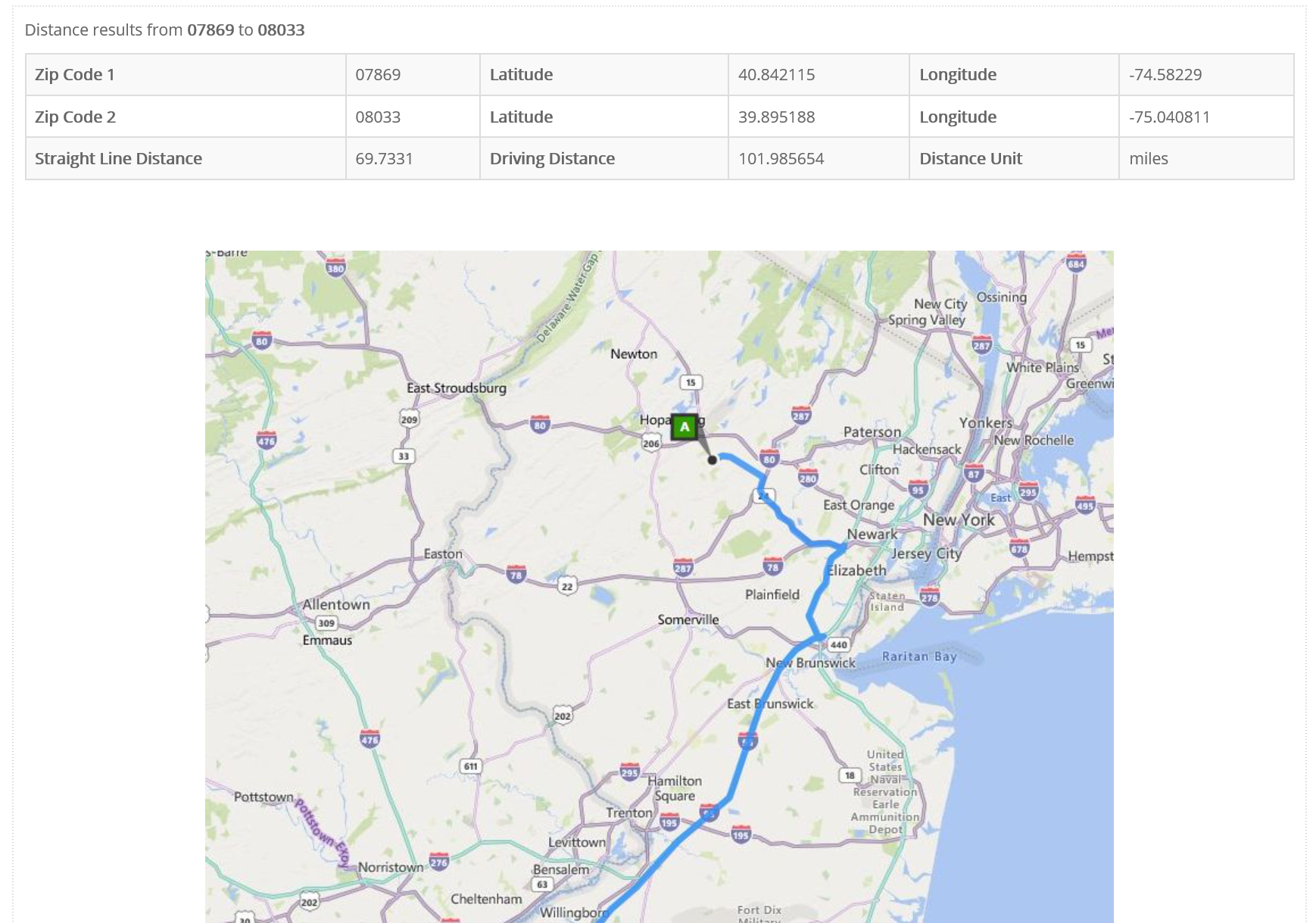
An example report for zip code 07869 to 08033 is shown on the right side of this screen. The report contains the straight line distance, driving distance, distance type, map and the latitude, and longitude for the locations specified.
If you need to calculate distance for many zip codes please check out our Zip Code Distance Batch Report. To analyze addresses instead of zip codes use our Routing Batch Report. Our CDXZipStream and CDXGeodata software can also calculate distances for long lists in Microsoft Excel or in other environments.
Data Usage
The information available on this site is the property of CDX Technologies, a division of Hughes Financial Services Inc. (HFS). HFS may license certain data feeds from others and this information remains the property of the copyright holders.
HFS grants the users of this site the right to access this data for personal, noncommercial purposes. No part of this site may be used for commercial purposes, except as permitted in writing by HFS.
Disclaimer
We have obtained this information from sources believed by us to be reliable. All information and reports provided to you AS IS
without warranty of any kind. Your use of the site indicates acceptance of these terms and we and our licensors will not be responsible for damages of any type.
Example Report